

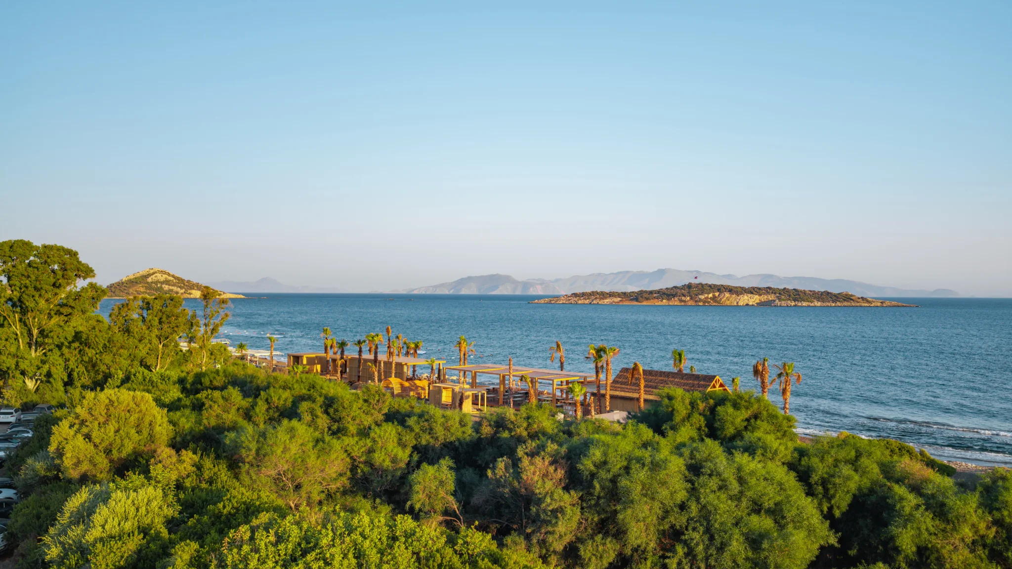
The Datça Peninsula is a slender, mountainous strip of land in south-west Muğla, stretching out towards the point where the Aegean meets the Mediterranean. Its indented coastline is dotted with countless coves, and with villages set among almond and olive groves and ancient cities thousands of years old, it rewards exploration even on a short stay.
Our hotel is in the Kızlan neighbourhood, on the Marmaris–Datça road, about 12 km by road from the centre of Datça. We have grouped the places below by area so that day trips are easy to plan. Distances are approximate and may vary with the road and the season.
Datça town and around
İskele and the harbour
Modern Datça is centred on İskele, the harbour quarter on the south coast; the district's administration moved here from Reşadiye in 1947. Cafés and restaurants line the waterfront promenade around the harbour, and the town comes alive from late afternoon onwards. Kumluk Beach is the town beach, within easy walking distance of the centre.
Ilıca Lake and Taşlık
In the middle of town, Ilıca is a small lake known for its ducks and fish. It is a calm spot for a short stroll and a rest by the water. Together with nearby Taşlık Beach, it makes an easy stop while you wander around the centre.
Old Datça (Eski Datça) and Reşadiye
Around 3 km inland from the harbour, on a hillside, Eski Datça keeps the peninsula's traditional character alive with narrow cobbled lanes, stone houses wrapped in bougainvillea and homes built around courtyards. Many of the old houses have been carefully brought back to life, and some now hold cafés, studios and craft shops. The poet and translator Can Yücel lived in Datça for many years and is buried here; his house in Eski Datça is regarded as one of the quarter's cultural landmarks.
Neighbouring Reşadiye served as the district centre until 1947. Since the early 20th century the peninsula has also been known as the Reşadiye Peninsula, after the Ottoman Sultan Mehmed V Reşad.
Burgaz (Old Knidos)
Just east of Datça town lies Burgaz, which most scholars identify as the original settlement of the Knidians; the city's centre of gravity is thought to have shifted to Tekir, at the tip of the peninsula, around the 4th century BC. Excavations led by Middle East Technical University (ODTÜ) since 1993 have revealed continuous occupation from the 8th century BC to the early Hellenistic period, together with four harbour basins. The remains are far less visible than at Knidos, and as this is an excavation site, it is worth checking access before you go.
Kızlan and the east of the peninsula
The Kızlan windmills
Kızlan, said to take its name from the reddish soil of the area, is home to one of Datça's emblems: six stone windmills rising in a line from the foot of a ridge to its top. Every one of them has its door facing south. Before roads and electricity reached the peninsula, the mills were an important part of the local economy, and their owners were counted among Datça's well-off families. One of the mills has been restored, and the row is now a regular stop for visitors to the peninsula.
The Sanctuary of Apollo at Emecik
Near the village of Emecik, east of Datça, lies a sanctuary of Apollo dating back to the Archaic period. Excavations begun by an ODTÜ team in 1998 uncovered terraces, a monumental Hellenistic building and an Early Byzantine church on the upper terrace. This is also an excavation site, so access may vary from season to season.
The west of the peninsula and Knidos
Ancient Knidos
At the western tip of the peninsula, on Cape Tekir where the Aegean and the Mediterranean meet, Knidos lies about 35 km from Datça town along a scenic road that winds through the hills. One of the important harbour cities of antiquity, Knidos was known for its wine trade and was home to the astronomer Eudoxus and to Sostratus, builder of the Pharos of Alexandria. The city spread across the slopes in terraces, laid out on the grid principle associated with Hippodamus of Miletus.
Two harbours and the theatres
Knidos was built partly on the mainland and partly on Deveboynu, once an island, and the causeway joining the two created a pair of harbours: one served warships and the other merchant vessels. The small theatre near the harbour has been excavated and restored, and the site also has a larger theatre, an odeon and sanctuaries to several deities.
The round temple and the Aphrodite of Knidos
Knidos owed its fame in the ancient world to the statue of Aphrodite that Praxiteles made for the city in the 4th century BC. The original has not survived and is known today through later copies. The foundations of a round temple on one of the city's upper terraces were long thought to mark where the statue stood, although, according to Türkiye's Culture Portal (Kültür Portalı), later research shows the building was dedicated to another deity.
Visiting
The archaeological site is run by the Ministry of Culture and Tourism, and excavations are carried out by a team from Selçuk University. Opening hours can change with the season, so please check the Ministry's page for current times before setting off. During the tourist season, Knidos can also be reached by boat. The site covers a large area, so we recommend bringing water, a hat and comfortable shoes.
Villages
Because of the threat of pirates, Datça's older villages were not built right on the shore but some way inland. Several of them therefore sit on hillsides, while the coves below have gradually become holiday spots. Set among olive and almond groves, these villages offer a close look at everyday life on the peninsula.
Hızırşah
Close to Datça town, Hızırşah is a rural conservation area that has kept its traditional architecture. Single-room houses of solid stone masonry are at the heart of the village's character. A short walk through the village gives a sense of the peninsula's older rural life.
Mesudiye and Hayıtbükü
Reached from Datça by a road that winds through pine trees, Mesudiye is a quiet hillside village surrounded by almond, olive and pomegranate trees. As you approach, the coves below open out in a wide view. Hayıtbükü, the village's bay, has a small jetty owned by the villagers.
Palamutbükü
About 25 km from Datça town, Palamutbükü is a holiday village with a long beach and a small pier where boats moor. This south-coast bay is easy to combine with a trip to Knidos.
Yazıköy
The last village on the road to Knidos, Yazıköy sits a little inland from Palamutbükü among almond and olive trees. It is known for its whitewashed houses with blue-painted doors and window frames and its cobbled lanes, and the archaeological site of Knidos lies within the village's boundaries.
Cumalı, Sındı and the Betçe villages
Mesudiye, Sındı, Yaka, Yazıköy and Cumalı, on the fertile land of the western peninsula, are traditionally known together as Betçe, meaning "the five villages". Small Cumalı and peaceful Sındı make pleasant places for a short break among the olive groves on the way to Knidos.
Viewpoints
- Balıkaşıran: arriving from Marmaris, you cross the narrowest part of the peninsula, where the road looks out over both the Gulf of Gökova and the Gulf of Hisarönü.
- The Kızlan windmills: the line of mills along the ridge is a regular stop for photographers.
- The road to Mesudiye: on the way down to the village, Hayıtbükü and the neighbouring coves come into wide view.
- Knidos and Deveboynu: from the upper terraces of the site you can take in the cape where the two seas meet and the ancient harbours together.
Useful links
- Knidos Archaeological Site: visitor information (Ministry of Culture and Tourism) (opens in a new tab)
- Muğla Knidos Archaeological Site (Turkish Museums) (opens in a new tab)
- Datça (Go Türkiye) (opens in a new tab)
- Old Datça (Datça District Governorship, in Turkish) (opens in a new tab)
- Windmills (Datça District Governorship, in Turkish) (opens in a new tab)